Home > Europe > United Kingdom > Scotland > Aberdeenshire > Ballater
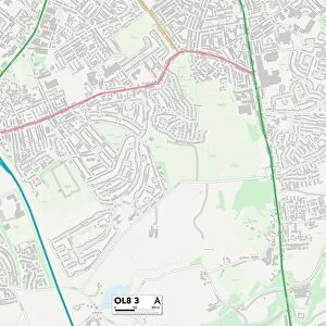
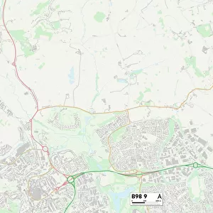
Leicester LE5 6 Map

![]()
Wall Art and Photo Gifts from Map Marketing
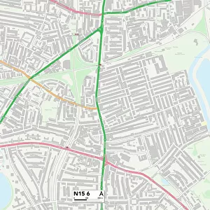
Leicester LE5 6 Map
Postcode Sector Map of Leicester LE5 6
Media ID 19973402
Aintree Close Barnstaple Road Bathurst Road Beechwood Close Bideford Road Blundell Road Church Road Cranwell Close Davenport Road Dawlish Close Delaware Road Earlswood Road Fallowfield Road Gifford Close Goodwood Road Greenacre Drive Greystone Avenue Hanbury Road Hardwick Road Hawthorne Drive Headland Road High Street Leicester Linden Drive Main Street Newhaven Road Rectory Gardens School Lane Shady Lane Silverwood Close The Common The Dell The Hollow Whitehall Road
FEATURES IN THESE COLLECTIONS
> Arts
> Contemporary art
> Landscapes
> Street art
> Europe
> United Kingdom
> Scotland
> Aberdeenshire
> Ballater
> Map Marketing
> Postcode Sector Maps
> LE - Leicester
> Maps and Charts
> Related Images
MADE IN THE USA
Safe Shipping with 30 Day Money Back Guarantee
FREE PERSONALISATION*
We are proud to offer a range of customisation features including Personalised Captions, Color Filters and Picture Zoom Tools
SECURE PAYMENTS
We happily accept a wide range of payment options so you can pay for the things you need in the way that is most convenient for you
* Options may vary by product and licensing agreement. Zoomed Pictures can be adjusted in the Cart.