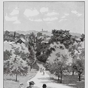
Home > Europe > United Kingdom > England > Bedfordshire > The Green
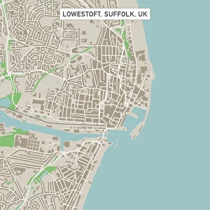
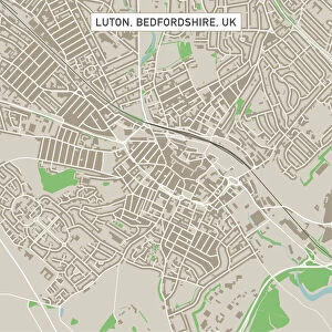
Luton Bedfordshire UK City Street Map

![]()
Wall Art and Photo Gifts from Fine Art Storehouse
Luton Bedfordshire UK City Street Map
Vector Illustration of a City Street Map of Luton, Bedfordshire, UK. Included files are EPS (v10) and Hi-Res JPG.
Data courtesy from Ordnance Survey: VectorMap District
https:/ordnancesurvey.co.uk/business-and-government/products/vectormap-district.html
OS OpenData is free to use under the Open Government Licence (OGL).
Contains OS data eCrown copyright and database right 2017.
http:/nationalarchives.gov.uk/doc/open-government-licence/version/3/
Unleash your creativity and transform your space into a visual masterpiece!
Frank Ramspott
Media ID 15055249
© Frank Ramspott, all rights reserved
Aerial View Bedfordshire Computer Graphic Directly Above Gray Green Road Map Street Map Text Digitally Generated Image Luton
FEATURES IN THESE COLLECTIONS
> Aerial Photography
> Related Images
> Arts
> Contemporary art
> Digital artwork
> Street art
> Arts
> Portraits
> Pop art gallery
> Street art portraits
> Arts
> Street art graffiti
> Digital art
> Digital paintings
> Arts
> Street art graffiti
> Digital art
> Vector illustrations
> Europe
> United Kingdom
> England
> Bedfordshire
> The Green
> Europe
> United Kingdom
> England
> Bedfordshire
> Luton
> Europe
> United Kingdom
> England
> Bedfordshire
> Related Images
> Europe
> United Kingdom
> Maps
> Fine Art Storehouse
> Map
> Street Maps
> Maps and Charts
> Related Images
EDITORS COMMENTS
This print showcases a meticulously detailed city street map of Luton, Bedfordshire in the United Kingdom. The vector illustration captures the essence of this vibrant city, highlighting its bustling streets and intricate road network. Created by Frank Ramspott, this digitally generated image is a testament to his exceptional cartography skills. The map includes essential files such as EPS (v10) and Hi-Res JPG, ensuring optimal quality for any purpose. It is worth noting that the data used in creating this masterpiece was courtesy of Ordnance Survey: VectorMap District, a reliable source known for its accuracy and precision. With shades of gray, green, blue, and white dominating the design, this visually appealing artwork effortlessly blends modernity with tradition. Its aerial view perspective allows viewers to appreciate Luton's physical geography from directly above. What makes this print even more remarkable is its versatility - it can be seamlessly incorporated into various settings without losing its charm. Whether displayed in an office space or at home, it adds depth and sophistication to any interior decor.
MADE IN THE USA
Safe Shipping with 30 Day Money Back Guarantee
FREE PERSONALISATION*
We are proud to offer a range of customisation features including Personalised Captions, Color Filters and Picture Zoom Tools
SECURE PAYMENTS
We happily accept a wide range of payment options so you can pay for the things you need in the way that is most convenient for you
* Options may vary by product and licensing agreement. Zoomed Pictures can be adjusted in the Cart.