Home > Arts > Artists > B > Willem Blaeu
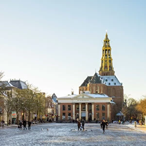
Map of Groningen, Netherlands, 17th century

![]()
Wall Art and Photo Gifts from Heritage Images
Map of Groningen, Netherlands, 17th century
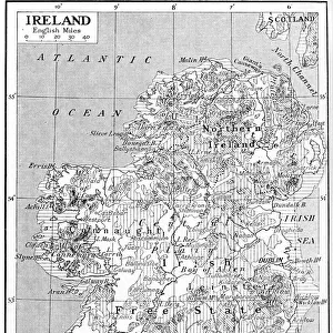
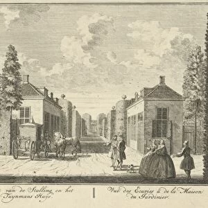
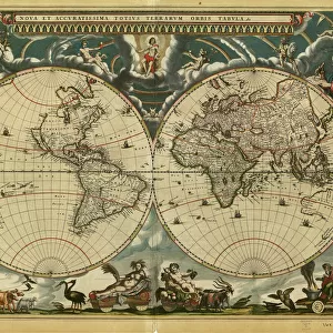
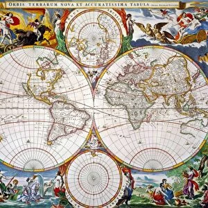
Map of Groningen, Netherlands, 17th century. A map of the Dutch province of Groningen, published by Willem Blaeu after the original design by Barthold Wicheringe
Heritage Images features heritage image collections
Media ID 14947077
© Print Collector / Heritage-Images
Blaeu Cartography Map Making North Sea Print Collector9 Willem Blaeu Barthold Groningen
FEATURES IN THESE COLLECTIONS
> Arts
> Artists
> B
> Willem Blaeu
> Europe
> Netherlands
> Groningen
> Europe
> Netherlands
> Maps
> Europe
> Netherlands
> Posters
> Europe
> Netherlands
> Related Images
> Maps and Charts
> Netherlands
> Maps and Charts
> Related Images
> Maps and Charts
> Willem Janszoon Blaeu
EDITORS COMMENTS
This print showcases a remarkable piece of cartography from the 17th century - the Map of Groningen, Netherlands. Created by Barthold Wicheringe and later published by Willem Blaeu, this map provides an intriguing glimpse into the geography and coastal features of the Dutch province. The intricate details on this map transport us back in time to a period when map-making was both an art form and a scientific endeavor. With its precise delineation of boundaries, waterways, and towns, it offers valuable insights into the country's historical landscape. As we explore this print further, our eyes are drawn to the North Sea coast that borders Groningen. The strategic location of this province made it a significant hub for trade and maritime activities during that era. The craftsmanship evident in this print is truly awe-inspiring. Each stroke meticulously captures every geographical feature with utmost precision. It serves as a testament to the skillful collaboration between Wicheringe and Blaeu, two renowned figures in cartographic history. Preserved through time by The Print Collector, this image allows us to appreciate not only its aesthetic beauty but also its invaluable contribution to our understanding of Groningen's past. Let us marvel at how these ancient maps continue to connect us with our ancestors' journeys across land and sea while reminding us of their enduring legacy in shaping our world today.
MADE IN THE USA
Safe Shipping with 30 Day Money Back Guarantee
FREE PERSONALISATION*
We are proud to offer a range of customisation features including Personalised Captions, Color Filters and Picture Zoom Tools
SECURE PAYMENTS
We happily accept a wide range of payment options so you can pay for the things you need in the way that is most convenient for you
* Options may vary by product and licensing agreement. Zoomed Pictures can be adjusted in the Cart.