Home > Animals > Birds > Passerines > Crows And Jays > Rook
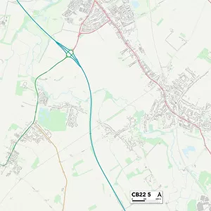
Uttlesford CB10 2 Map

![]()
Wall Art and Photo Gifts from Map Marketing
Uttlesford CB10 2 Map
Postcode Sector Map of Uttlesford CB10 2
Media ID 19967418
All Saints Close Andrews Close Archer Road Brooke Avenue Bush Road Butlers Lane Castle Hill Church End Church Field Church Hill Church Road Coach Road Dark Lane Dawson Close Elder Street Elizabeth Close Elizabeth Way Fairfax Drive Ferguson Close Golden Lane Hall Road High Street Highfields Hill Road Howard Road Howe Lane Jennings Road Lime Avenue Longcroft Lords Close Lower Green Mill Lane Mill Road Miller Street Neville Road New House Lane Parsonage Lane Pearson Road Portsmouth Close Ravenscroft Rectory Lane Shepherds Way St Marys View The Common Top Road Tye Green Upper Green Uttlesford Walden Avenue Walden Road Wallace Road Water End Water Lane Hempstead Horn Book Shrublands
FEATURES IN THESE COLLECTIONS
> Animals
> Birds
> Passerines
> Chats And Flycatchers
> Nightingale
> Animals
> Birds
> Passerines
> Crows And Jays
> Rook
> Animals
> Mammals
> Cricetidae
> Golden Mouse
> Animals
> Reptiles
> Lizards
> Green Water Dragon
> Arts
> Artists
> B
> Mary Butler
> Europe
> United Kingdom
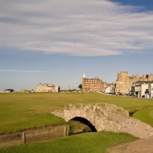
> Scotland
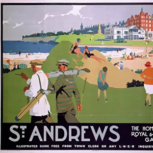
> Fife
> St Andrews
> Europe
> United Kingdom
> Scotland
> Strathclyde
> Hamilton
> Map Marketing
> Postcode Sector Maps
> CB - Cambridge
> Maps and Charts
> Related Images
MADE IN THE USA
Safe Shipping with 30 Day Money Back Guarantee
FREE PERSONALISATION*
We are proud to offer a range of customisation features including Personalised Captions, Color Filters and Picture Zoom Tools
SECURE PAYMENTS
We happily accept a wide range of payment options so you can pay for the things you need in the way that is most convenient for you
* Options may vary by product and licensing agreement. Zoomed Pictures can be adjusted in the Cart.