Home > Europe > United Kingdom > England > London > Sights > Heathrow Airport
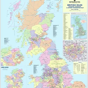
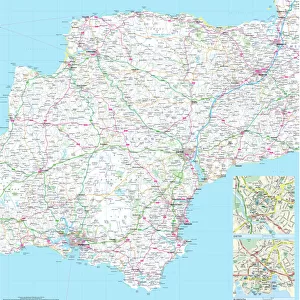
100 Miles Around London Map

![]()
Wall Art and Photo Gifts from Map Marketing
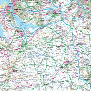
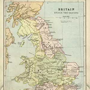
100 Miles Around London Map
A clear map covering a 100-mile radius around London. Specially produced for the commercial driver and practical motorist, designed for planning of sales and transportation within a 100-mile radius of London. Roads are colour-coded for easy use, road numbers and distances are shown in a format that is clear and easy to read. Also includes county boundaries, airports and ferry routes. The area covered is from Bristol to the East coast and from Stoke-on-Trent to the South coast
Media ID 19949535
© Map Marketing Ltd
FEATURES IN THESE COLLECTIONS
> Europe
> United Kingdom
> England
> Bristol
> Bristol
> Europe
> United Kingdom
> England
> London
> Sights
> Heathrow Airport
> Europe
> United Kingdom
> England
> Maps
> Europe
> United Kingdom
> England
> Stoke-on-Trent
> Maps and Charts
> Related Images
MADE IN THE USA
Safe Shipping with 30 Day Money Back Guarantee
FREE PERSONALISATION*
We are proud to offer a range of customisation features including Personalised Captions, Color Filters and Picture Zoom Tools
SECURE PAYMENTS
We happily accept a wide range of payment options so you can pay for the things you need in the way that is most convenient for you
* Options may vary by product and licensing agreement. Zoomed Pictures can be adjusted in the Cart.