Home > Popular Themes > Antarctic Expedition
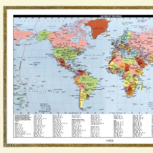
Map of Scotts and Amundsens route to the South Pole

Wall Art and Photo Gifts from Scott Polar Research Institute
Map of Scotts and Amundsens route to the South Pole
Expedition: British Antarctic Expedition 1910-13. Photograph of map showing Scotts and Amundsens route to the Pole (variation made by Ponting)
Scott Polar Research Institute, Cambridge, offers excellence in the study of the Arctic and Antarctic
Media ID 13120273
© Scott Polar Research Institute, University of Cambridge
FEATURES IN THESE COLLECTIONS
> Maps and Charts
> Popular Maps
> Maps and Charts
> Related Images
> Popular Themes
> Antarctic Expedition
> Scott Polar Research Institute
> British Antarctic Expedition 1910-13
EDITORS COMMENTS
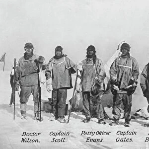
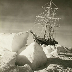
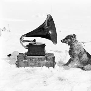
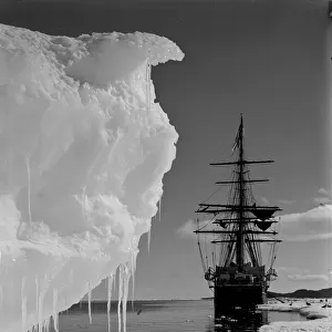
This print showcases a historical treasure, the "Map of Scotts and Amundsens route to the South Pole". A relic from the renowned British Antarctic Expedition 1910-13, this photograph captures a variation made by Ponting, an esteemed member of the expedition. Preserved by the University of Cambridge SPRI (Scott Polar Research Institute), this map offers a fascinating glimpse into one of humanity's most daring adventures. The image depicts intricate details that trace Captain Robert Falcon Scott's and Roald Amundsen's arduous journeys towards the elusive South Pole. Each line etched on this map represents countless hours of meticulous planning, unwavering determination, and unimaginable hardships endured in pursuit of scientific discovery and national pride. As we gaze upon this historic artifact, our minds are transported back to an era when explorers braved treacherous terrains with limited resources and unyielding spirits. The map serves as a testament to human resilience in extreme conditions while shedding light on the pioneering spirit that drove these men forward. Beyond its historical significance lies another layer of intrigue – Ponting's unique interpretation. His artistic touch adds depth and character to this already remarkable piece. Through his lens, he immortalizes not only their routes but also their indomitable spirit against nature's harshest elements. In preserving this Map at SPRI, the University of Cambridge ensures that future generations can appreciate both its aesthetic beauty and invaluable insights into polar exploration. This photograph print is more than just an archival document; it encapsulates tales untold yet waiting to be discovered within its contours. Whether you're an adventurer at heart or simply fascinated by history, allow yourself to be captivated by this extraordinary visual representation – a window into mankind's relentless quest for knowledge amidst unforgiving icy landscapes.
MADE IN THE USA
Safe Shipping with 30 Day Money Back Guarantee
FREE PERSONALISATION*
We are proud to offer a range of customisation features including Personalised Captions, Color Filters and Picture Zoom Tools
SECURE PAYMENTS
We happily accept a wide range of payment options so you can pay for the things you need in the way that is most convenient for you
* Options may vary by product and licensing agreement. Zoomed Pictures can be adjusted in the Cart.