Home > Arts > Contemporary art > Digital artwork > Street art
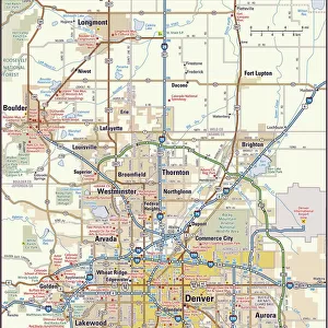
CT Fairfield Shelton Vector Road Map

![]()
Wall Art and Photo Gifts from Fine Art Storehouse
CT Fairfield Shelton Vector Road Map
CT Fairfield Shelton Vector Road Map. All source data is in the public domain. U.S. Census Bureau Census Tiger. Used Layers: areawater, linearwater, roads, rails, cousub, pointlm, uac10
Unleash your creativity and transform your space into a visual masterpiece!
Frank Ramspott
Media ID 20688199
© Frank Ramspott, all rights reserved
City Map Computer Graphic Connecticut County Derby Digital Composite District Fairfield Geographical Border Road Map Text Vector Digitally Generated Image Housatonic River Huntington Monroe Shelton Sunnyside White Hill
FEATURES IN THESE COLLECTIONS
> Animals
> Mammals
> Cats (Wild)
> Tiger
> Animals
> Mammals
> Muridae
> Water Mouse
> Arts
> Contemporary art
> Digital artwork
> Street art
> Arts
> Landscape paintings
> Waterfall and river artworks
> River artworks
> Arts
> Portraits
> Pop art gallery
> Street art portraits
> Arts
> Street art graffiti
> Digital art
> Digital paintings
> Fine Art Storehouse
> Map
> Reference Maps
> Maps and Charts
> Related Images
> Popular Themes
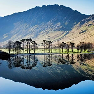
> Lake District
EDITORS COMMENTS
This print showcases the intricate details of the CT Fairfield Shelton Vector Road Map. Created by talented cartographer Frank Ramspott, this digitally generated image is a testament to his exceptional design skills and attention to detail. The map encompasses various layers sourced from public domain data, including areawater, linearwater, roads, rails, cousub, pointlm, and uac10. Utilizing vibrant colors and precise vector graphics, Ramspott has beautifully captured the physical geography of Connecticut's Fairfield County district. With no people in sight, this color image focuses solely on the geographical borders of cities and towns within the region. From bustling cityscapes to serene riverside landscapes, every element is meticulously depicted in this computer-generated masterpiece. Notable landmarks such as White Hill, Monroe, Ansonia Derby Huntington Sunnyside Oronoque Kinneytown Housatonic River add further depth to this visually stunning composition. The inclusion of text enhances its functionality as a road map while maintaining its artistic appeal. Ideal for both navigation purposes and aesthetic appreciation of cartography enthusiasts alike; this digital composite effortlessly combines technology with artistry. Whether displayed in an office or home setting; it serves as a reminder of our interconnectedness through transportation networks that shape our daily lives
MADE IN THE USA
Safe Shipping with 30 Day Money Back Guarantee
FREE PERSONALISATION*
We are proud to offer a range of customisation features including Personalised Captions, Color Filters and Picture Zoom Tools
SECURE PAYMENTS
We happily accept a wide range of payment options so you can pay for the things you need in the way that is most convenient for you
* Options may vary by product and licensing agreement. Zoomed Pictures can be adjusted in the Cart.