Home > Arts > Contemporary art > Digital artwork > Street art
MA Plymouth Wareham Vector Road Map

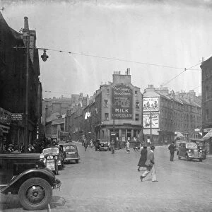
![]()
Wall Art and Photo Gifts from Fine Art Storehouse
MA Plymouth Wareham Vector Road Map
MA Plymouth Wareham Vector Road Map. All source data is in the public domain. U.S. Census Bureau Census Tiger. Used Layers: areawater, linearwater, roads, rails, cousub, pointlm, uac10
Unleash your creativity and transform your space into a visual masterpiece!
Frank Ramspott
Media ID 20692665
© Frank Ramspott, all rights reserved
Bourne Buzzards Bay City Map Computer Graphic County Digital Composite District Geographical Border Harbor Massachusetts Plymouth Road Map Text Vector Digitally Generated Image Marion Wareham
FEATURES IN THESE COLLECTIONS
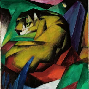
> Animals
> Mammals
> Cats (Wild)
> Tiger
> Animals
> Mammals
> Muridae
> Water Mouse
> Arts
> Contemporary art
> Digital artwork
> Street art
> Arts
> Landscape paintings
> Waterfall and river artworks
> River artworks
> Arts
> Portraits
> Pop art gallery
> Street art portraits
> Arts
> Street art graffiti
> Digital art
> Digital paintings
> Fine Art Storehouse
> Map
> Reference Maps
> Historic
> Monuments and landmarks
> Monuments and memorials
> Historic
> Monuments and landmarks
> Maps and Charts
> Related Images
> Popular Themes
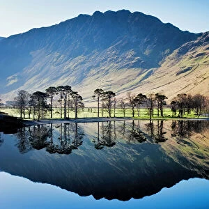
> Lake District
EDITORS COMMENTS
This print showcases the MA Plymouth Wareham Vector Road Map, a stunning piece of cartography art created by Frank Ramspott. The artist has skillfully designed this digitally generated image using various layers sourced from public domain data, including areawater, linearwater, roads, rails, cousub, pointlm, and uac10. The vibrant colors and intricate details bring this map to life as it highlights the geographical borders of Massachusetts. From bustling cities to serene coastlines, every element is meticulously depicted in this visually striking composition. The city streets intertwine with rivers and lakes while text labels guide us through the different districts and counties. Plymouth Harbor takes center stage in this artwork as its sparkling waters blend seamlessly with Buzzards Bay. The towns of Wareham and Onset add charm to the coastal landscape while Weweantic and Tihonet provide a glimpse into their natural beauty. As we explore further along the map's edges, we encounter Bourne's Monument Beach nestled amidst picturesque surroundings. Marion also makes an appearance with its own unique character that adds depth to this comprehensive representation of Massachusetts' diverse landscapes. Frank Ramspott's digital composite effortlessly combines elements of physical geography with computer graphics to create a truly mesmerizing work of art. This color image invites viewers on a visual journey through the rich tapestry of Massachusetts' topography without any mention or intention for commercial use - simply appreciating the beauty found within our world.
MADE IN THE USA
Safe Shipping with 30 Day Money Back Guarantee
FREE PERSONALISATION*
We are proud to offer a range of customisation features including Personalised Captions, Color Filters and Picture Zoom Tools
SECURE PAYMENTS
We happily accept a wide range of payment options so you can pay for the things you need in the way that is most convenient for you
* Options may vary by product and licensing agreement. Zoomed Pictures can be adjusted in the Cart.