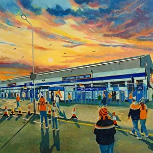
Home > Europe > United Kingdom > England > London > Sights > Mile End Park
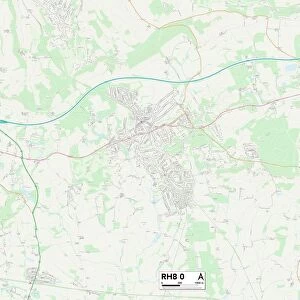
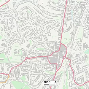
Tandridge RH8 9 Map

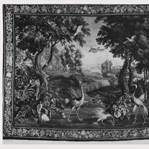
![]()
Wall Art and Photo Gifts from Map Marketing
Tandridge RH8 9 Map
Postcode Sector Map of Tandridge RH8 9
Media ID 19976454
Barnfield Way Brook Hill Church Lane Church Way Fairfax Close Godstone Road Greenwood Gardens Grove Road High Street Holland Road Juniper Close Laurel Drive Meadowbrook Miles Lane Mill Lane New Road Orchard Way Parklands Popes Lane Quarry Close Quarry Road Rosemary Close Sandy Lane Spring Lane Springfield The Hawthorns The Maltings The Walk Warren Lane West Hill Wilderness Road Williams Road Woodland Rise Hall Hill
FEATURES IN THESE COLLECTIONS
> Arts
> Landscape paintings
> Forest and woodland scenes
> Wilderness-inspired art
> Europe
> United Kingdom
> England
> London
> Sights
> Holland Park
> Europe
> United Kingdom
> England
> London
> Sights
> Mile End Park
> Map Marketing
> Postcode Sector Maps
> RH - Redhill
> Maps and Charts
> Related Images
MADE IN THE USA
Safe Shipping with 30 Day Money Back Guarantee
FREE PERSONALISATION*
We are proud to offer a range of customisation features including Personalised Captions, Color Filters and Picture Zoom Tools
SECURE PAYMENTS
We happily accept a wide range of payment options so you can pay for the things you need in the way that is most convenient for you
* Options may vary by product and licensing agreement. Zoomed Pictures can be adjusted in the Cart.