Home > Animals > Fishes > R > Roach
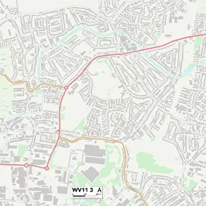
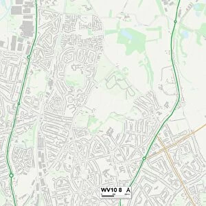
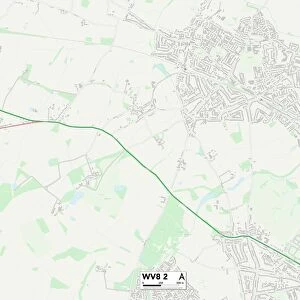
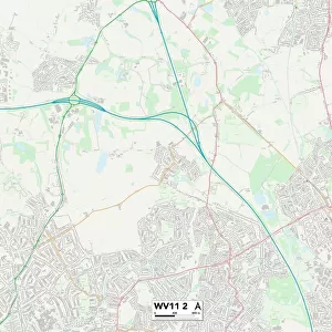
Wolverhampton WV11 2 Map

![]()
Wall Art and Photo Gifts from Map Marketing
Wolverhampton WV11 2 Map
Postcode Sector Map of Wolverhampton WV11 2
Media ID 19983370
Acorn Road Ashmore Avenue Aspen Road Barnard Road Birch Road Birchwood Close Blackthorn Court Bloomfield Drive Brindley Avenue Broad Lane Buttermere Drive Charles Avenue Clare Avenue Cleveland Close Coppice Close Danes Close Downing Close Drummond Close Elmwood Avenue Exton Close Ferguson Street Ferndale Road Gilbert Close Gorse Road Hawthorne Road Hill Place Hill Street Hilton Lane Howard Road Kingsway Long Lane Meadow View Millbank Street Mitre Close New Street Oakwood Close Palmer Close Park Close Park Way Parker Road Parry Road Peacock Avenue Radstock Road Red Lane Rogers Close Rosemary Court Rosewood Gardens Rowan Drive Russell Close Springhill St Albans Close St Johns Road Stanley Close Stephens Close The Gables Thirlmere Drive Thornley Close Thornley Road Tudor Court Vernon Close Vernon Way Whitehouse Crescent Willow Grove Wolverhampton Wolverhampton Road Essington High Hill
FEATURES IN THESE COLLECTIONS
> Animals
> Fishes
> R
> Roach
> Arts
> Artists
> B
> John Barnard
> Arts
> Artists
> D
> John Drummond
> Arts
> Artists
> G
> John Gilbert
> Arts
> Artists
> H
> John Hillers
> Arts
> Artists
> H
> John Hills
> Arts
> Artists
> P
> Charles Phillips
> Arts
> Artists
> P
> John Parker
> Arts
> Artists
> P
> John Phillip
> Arts
> Artists
> R
> Charles Russell
> Map Marketing
> Postcode Sector Maps
> WV - Wolverhampton
MADE IN THE USA
Safe Shipping with 30 Day Money Back Guarantee
FREE PERSONALISATION*
We are proud to offer a range of customisation features including Personalised Captions, Color Filters and Picture Zoom Tools
SECURE PAYMENTS
We happily accept a wide range of payment options so you can pay for the things you need in the way that is most convenient for you
* Options may vary by product and licensing agreement. Zoomed Pictures can be adjusted in the Cart.