Home > Europe > United Kingdom > Wales > Powys > Newtown
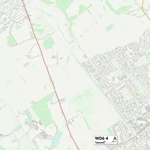
Purbeck BH20 5 Map

![]()
Wall Art and Photo Gifts from Map Marketing
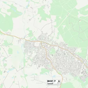
Purbeck BH20 5 Map
Postcode Sector Map of Purbeck BH20 5
Media ID 19965556
Barnhill Road Beech Close Church Lane Church Road Corfe Road East Street Farm Lane Fifth Street Forest Lane Gallows Hill Grange Hill Grange Road Jubilee Gardens Kingston Langton Road Main Road Mead Road Mount Pleasant New Road Oaklands Close Purbeck School Lane Scott Close Shepherds Way Shirley Close Sixth Street South Street Springwell Close Studland Road Sunnyside The Drove The Lane The Oval The Square Townsend Road Vale Road Valley Road West Lane West Road West Street Arne Cockles Corfe Castle Kimmeridge Kingston Hill Lulworth Cove Norden Ridge Seventh Street Steeple Tenth Street West Lulworth
FEATURES IN THESE COLLECTIONS
> Animals
> Birds
> Passerines
> Mockingbirds And Thrashers
> Related Images
> Animals
> Mammals
> Muridae
> Heath Mouse
> Animals
> Mollusks
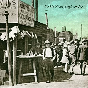
> Cockles
> Arts
> Landscape paintings
> Forest and woodland scenes
> Forest artwork
> Europe
> United Kingdom
> Wales
> Powys
> Newtown
> Historic
> Battles
> Related Images
> Map Marketing
> Postcode Sector Maps
> BH - Bournemouth
> Maps and Charts
> Related Images
> Popular Themes
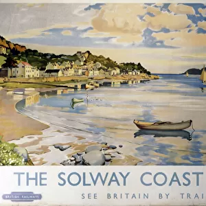
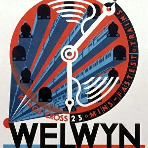
> Railway Posters
MADE IN THE USA
Safe Shipping with 30 Day Money Back Guarantee
FREE PERSONALISATION*
We are proud to offer a range of customisation features including Personalised Captions, Color Filters and Picture Zoom Tools
SECURE PAYMENTS
We happily accept a wide range of payment options so you can pay for the things you need in the way that is most convenient for you
* Options may vary by product and licensing agreement. Zoomed Pictures can be adjusted in the Cart.