Home > Europe > Denmark > Copenhagen
The Baltic Sea and Its Approaches, First World War, c1915, (c1920)
")
![]()
Wall Art and Photo Gifts from Heritage Images
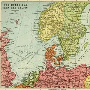
The Baltic Sea and Its Approaches, First World War, c1915, (c1920)
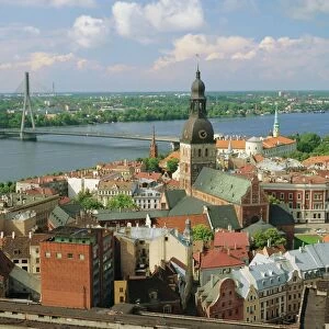
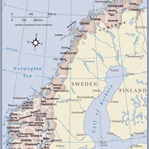
The Baltic Sea and Its Approaches, First World War, c1915, (c1920). Map of part of northern Europe, showing sections of the coasts of Norway, Sweden, Russia, Germany and Denmark. From " The Great World War - A History" Volume IV, edited by Frank A Mumby. [The Gresham Publishing Company Ltd, London, c1920]
Heritage Images features heritage image collections
Media ID 19174547
© The Print Collector/Heritage Images
Baltic Sea Bartholomew Bartholomew And Co Bartholomew Co Bartholomew John Son Copenhagen Copenhagen Kobenhavn Denmark Danzig Frank Arthur Frank Arthur Mumby Gresham Publishing Co Ltd Gresham Publishing Company Hamburg Hamburg Germany Island Islands Jg Bartholomew John And Son John Bartholomew And Co John Bartholomew And Son John Bartholomew And Son Ltd John Bartholomew Co John Bartholomew Son John Bartholomew Son Ltd John Son Keystone Archives Kobenhavn Latvia Mumby Mumby Frank Arthur North Sea Norway Riga Stockholm Stockholm Sweden Strait The Great World War A History Theatre Of War Skagerrak
FEATURES IN THESE COLLECTIONS
> Europe
> Denmark
> Copenhagen
> Europe
> Denmark
> Related Images
> Europe
> Latvia
> Related Images
EDITORS COMMENTS
This print titled "The Baltic Sea and Its Approaches, First World War" takes us back in time to the early 20th century. The map, originally featured in the book "The Great World War - A History" provides a detailed view of part of northern Europe during this tumultuous period. In vibrant color, the map showcases sections of the coasts of Norway, Sweden, Russia, Germany, and Denmark. It highlights major cities such as Copenhagen and Hamburg while also featuring smaller coastal towns like Danzig and Riga. Islands scattered across the Baltic Sea are clearly marked, adding depth to this geographical representation. Created by John Bartholomew & Son Ltd. , renowned cartographers of their time, this print exemplifies their expertise in capturing intricate details with precision. The historical significance lies within its connection to the First World War era when these regions played vital roles in shaping European history. As we gaze upon this remarkable piece of artistry from Heritage Images' collection, we are transported back to a time when geopolitical boundaries were shifting amidst global conflict. This print serves as a visual reminder of how geography can shape destinies and influence world events.
MADE IN THE USA
Safe Shipping with 30 Day Money Back Guarantee
FREE PERSONALISATION*
We are proud to offer a range of customisation features including Personalised Captions, Color Filters and Picture Zoom Tools
SECURE PAYMENTS
We happily accept a wide range of payment options so you can pay for the things you need in the way that is most convenient for you
* Options may vary by product and licensing agreement. Zoomed Pictures can be adjusted in the Cart.