Home > Fine Art Finder > Schools > Italian School
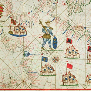
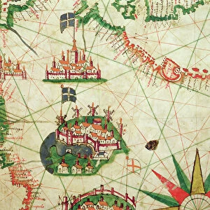
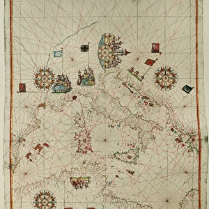
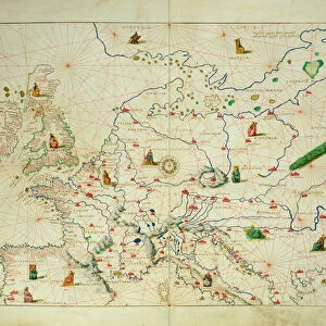
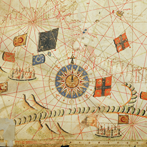
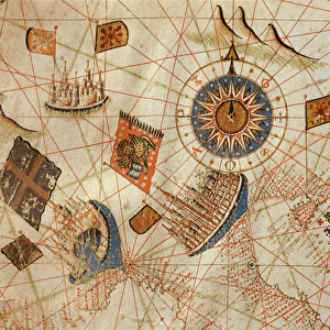
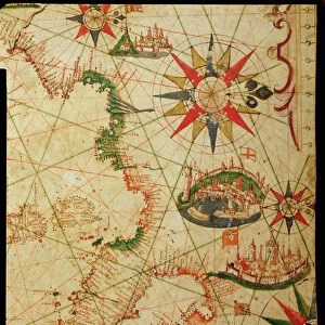
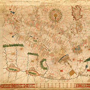
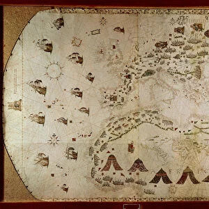
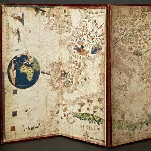
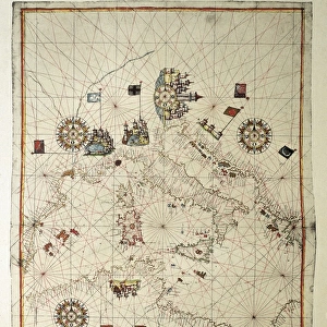
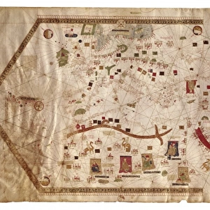
The Mediterranean Basin, from a nautical atlas, 1646 (ink on vellum) (see also 330937-330938)
 (see also 330937-330938)")
![]()
Wall Art and Photo Gifts from Fine Art Finder
The Mediterranean Basin, from a nautical atlas, 1646 (ink on vellum) (see also 330937-330938)
XOT330936 The Mediterranean Basin, from a nautical atlas, 1646 (ink on vellum) (see also ) by Italian School, (17th century); Museo Correr, Venice, Italy; Italian, out of copyright
Media ID 12852629
© www.bridgemanart.com
Chart Compass Corsica Mapping Portolan Sardinia Sicily Baleric Islands
EDITORS COMMENTS
This print showcases a stunning piece of historical artwork titled "The Mediterranean Basin, from a nautical atlas, 1646". Created by an anonymous Italian artist in the 17th century, this ink on vellum masterpiece is currently housed at the Museo Correr in Venice, Italy. The intricate details and exquisite craftsmanship of this map immediately transport viewers to a time when cartography was both an art form and a vital navigational tool. The map encompasses the vast expanse of the Mediterranean Basin, featuring countries such as Italy, France, Spain, Greece, and various islands including Sicily, Sardinia, Corsica, and the Balearic Islands. As one gazes upon this ancient treasure trove of geographical knowledge, it becomes evident that it served not only as a guide for sailors but also as a symbol of power and authority. With its depiction of cities and rulers' territories marked with precision alongside compass roses indicating cardinal directions - every element has been meticulously crafted to provide accurate information. This print allows us to appreciate not only the beauty but also the historical significance behind this remarkable work. It serves as a reminder that maps have always played an essential role in shaping our understanding of the world around us while simultaneously showcasing humanity's innate desire to explore new horizons.
MADE IN THE USA
Safe Shipping with 30 Day Money Back Guarantee
FREE PERSONALISATION*
We are proud to offer a range of customisation features including Personalised Captions, Color Filters and Picture Zoom Tools
SECURE PAYMENTS
We happily accept a wide range of payment options so you can pay for the things you need in the way that is most convenient for you
* Options may vary by product and licensing agreement. Zoomed Pictures can be adjusted in the Cart.