Home > Asia > Turkey > Istanbul
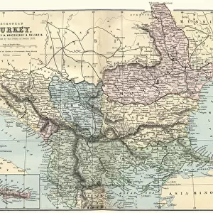
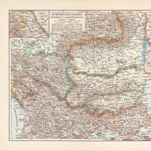
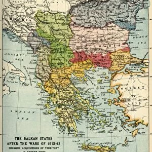
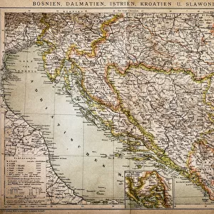
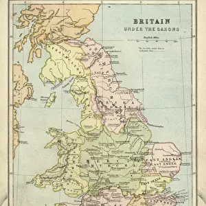
Ottoman Empire, 14th-19th century, lithograph, published in 1878

![]()
Wall Art and Photo Gifts from Fine Art Storehouse
Ottoman Empire, 14th-19th century, lithograph, published in 1878
Ancient map of the history of European Turkey, 15th - 19th century. Lithograph, published in 1878
Unleash your creativity and transform your space into a visual masterpiece!
Media ID 13666831
© ZU_09
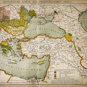
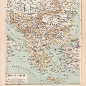
Adriatic Sea Aegean Sea Albania Austria Austria Hungary Balkans Black Sea Bosnia And Hercegovina Bulgaria Bulgarian Culture Contour Drawing Country Geographic Area Crete Greece Greek Culture Hungary Image Date Ionian Sea Istanbul Mediterranean Sea Ottoman Empire Romania Serbia Serbian Culture Topographic Map Topography Turkey Middle East Albanian Culture Obsolete Romanian Culture
FEATURES IN THESE COLLECTIONS
> Asia
> Turkey
> Related Images
> Europe
> Albania
> Related Images
> Europe
> Austria
> Related Images
> Europe
> Bosnia and Herzegovina
> Maps
> Fine Art Storehouse
> Map
> Historical Maps
EDITORS COMMENTS
This lithograph, published in 1878, offers a fascinating glimpse into the rich history of the Ottoman Empire during the 14th to 19th centuries. The ancient map showcases the topography and cultural diversity of European Turkey, presenting an intricate web of nations and regions that once thrived under Ottoman rule. The meticulously engraved image takes us on a journey through time, revealing significant geographical features such as the Adriatic Sea, Ionian Sea, Aegean Sea, Mediterranean Sea, and Black Sea. From Istanbul in modern-day Turkey to Hungary, Romania to Bulgaria; Albania to Serbia; Bosnia and Hercegovina to Greece - this comprehensive depiction encompasses vast territories influenced by Greek culture and Roman heritage. With its vertical composition exuding a sense of grandeur and importance, this antique lithograph serves as both a historical document and a work of art. Its contour drawing beautifully captures the intricate details of each country's geographic area while highlighting their unique cultural identities. As we gaze upon this relic from the past in awe-inspiring detail, it reminds us of how much has changed since its creation over 140 years ago. Yet it also serves as a reminder that history is not confined to textbooks but can be experienced through visual representations like this remarkable lithograph.
MADE IN THE USA
Safe Shipping with 30 Day Money Back Guarantee
FREE PERSONALISATION*
We are proud to offer a range of customisation features including Personalised Captions, Color Filters and Picture Zoom Tools
SECURE PAYMENTS
We happily accept a wide range of payment options so you can pay for the things you need in the way that is most convenient for you
* Options may vary by product and licensing agreement. Zoomed Pictures can be adjusted in the Cart.