Home > Fine Art Storehouse > The Magical World of Illustration > Palmer Illustrated Collection
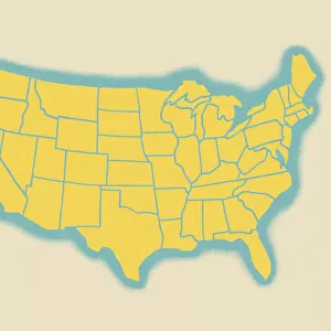
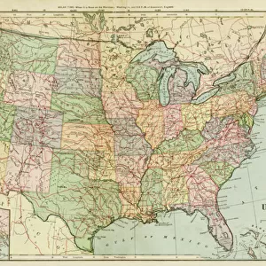
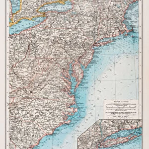
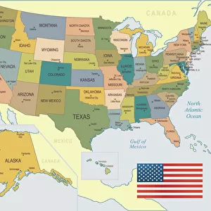
USA states map 1875

![]()
Wall Art and Photo Gifts from Fine Art Storehouse
USA states map 1875
The Independent Course Comprehensive Geography by James Monteith, A.S. Barnes & Co, New York & Chicago 1875
Unleash your creativity and transform your space into a visual masterpiece!
THEPALMER
Media ID 13612191
© This content is subject to copyright
Globe Navigational Equipment Michigan Minnesota Paper Wisconsin Drawing Art Product
FEATURES IN THESE COLLECTIONS
> Fine Art Storehouse
> The Magical World of Illustration
> Palmer Illustrated Collection
> Fine Art Storehouse
> Map
> Historical Maps
> Fine Art Storehouse
> Map
> USA Maps
EDITORS COMMENTS
This print takes us back in time to the year 1875, when cartography was a true art form. The USA states map depicted here is from "The Independent Course Comprehensive Geography" by James Monteith, published by A. S. Barnes & Co in New York and Chicago. This antique piece showcases the intricate details of each state, including Michigan, Minnesota, and Wisconsin. Engraved with precision and etched onto paper, this horizontal image transports us to an era where globe navigational equipment played a crucial role in mapping out our world. The craftsmanship evident in this illustration highlights the dedication and skill of those who created it. As we gaze upon this old engraved image, we can't help but appreciate its historical significance. It serves as a reminder of how physical geography has shaped our understanding of the world throughout centuries. "The Independent Course Comprehensive Geography" holds immense value for collectors and enthusiasts alike. THEPALMER's fine art storehouse brings forth this remarkable piece that captures not only the beauty of cartography but also offers a glimpse into America's past. Whether you are an avid collector or simply fascinated by history, this print is sure to transport you on a journey through time while celebrating the artistry behind map-making during one of America's most transformative periods.
MADE IN THE USA
Safe Shipping with 30 Day Money Back Guarantee
FREE PERSONALISATION*
We are proud to offer a range of customisation features including Personalised Captions, Color Filters and Picture Zoom Tools
SECURE PAYMENTS
We happily accept a wide range of payment options so you can pay for the things you need in the way that is most convenient for you
* Options may vary by product and licensing agreement. Zoomed Pictures can be adjusted in the Cart.