Home > Africa > Algeria > Maps
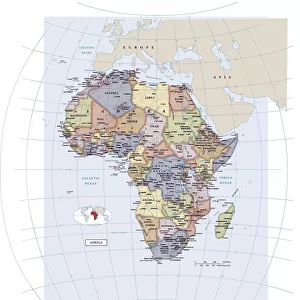
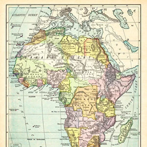
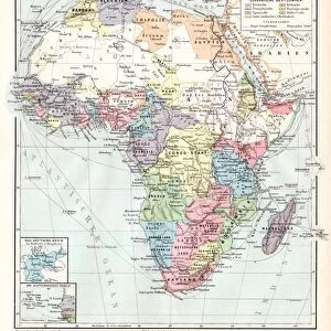
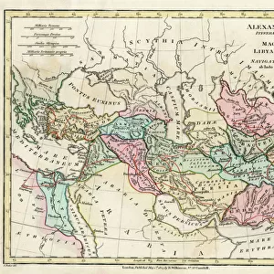
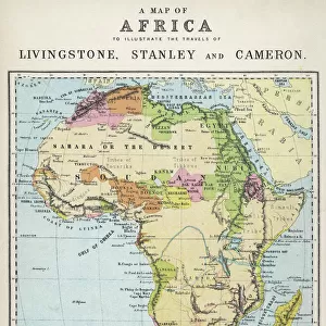
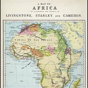
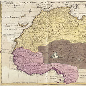
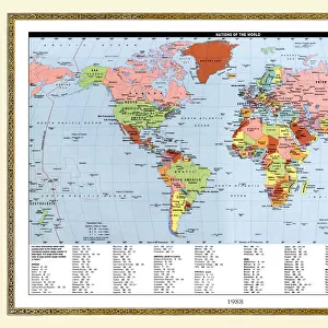
Political Map of Africa

Wall Art and Photo Gifts from Fine Art Storehouse
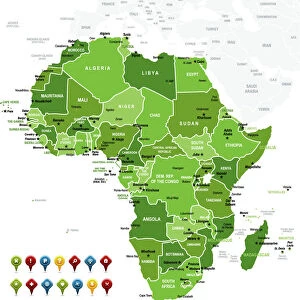
Political Map of Africa
Vector Illustration of the policital map of Africa
Reference map as created by the US Central Intelligence Agency
Unleash your creativity and transform your space into a visual masterpiece!
calvindexter
Media ID 20251035
Adventure Algeria Backgrounds Business Concepts Creativity Data Design Element Division Exploration Global Communications Government Icon Ideas Indian Ocean Infographic International Border Island Journey Kenya Land Libya Madagascar Newspaper Outline Politics Sign Silhouette South Africa Sudan Symbol Technology Topography Trip Unity Vector World Map Mauritania Nigeria Political Map Social Media South Atlantic Ocean
FEATURES IN THESE COLLECTIONS
> Africa
> Algeria
> Related Images
> Africa
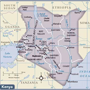
> Kenya
> Related Images
> Africa
> Libya
> Related Images
> Africa
> Madagascar
> Maps
> Africa
> Madagascar
> Related Images
> Africa
> Mauritania
> Maps
> Africa
> Mauritania
> Related Images
> Fine Art Storehouse
> Map
> Reference Maps
> Fine Art Storehouse
> Top Sellers - Art Prints
> Maps and Charts
> Popular Maps
EDITORS COMMENTS
This print showcases the intricate and detailed "Political Map of Africa". Created by the US Central Intelligence Agency, this vector illustration is a true masterpiece of cartography. The map encompasses the vast African continent, highlighting its diverse countries and their political boundaries. With its vibrant colors and precise design elements, this artwork sparks creativity and ignites a sense of exploration. It invites viewers on a journey to discover Africa's rich cultural heritage, breathtaking coastlines, and enchanting islands. Whether you are an adventurer or simply fascinated by world maps, this print will transport you to new horizons. Beyond its aesthetic appeal, this map symbolizes more than just geography; it represents government systems, politics, unity, division, global communications, and international borders. It serves as a powerful reminder of our interconnectedness in today's fast-paced world. Perfect for any business or technology setting seeking inspiration or adding visual interest to their space - be it an office backdrop or social media content - this print seamlessly combines artistry with informative data. Its topographical features beautifully depict Africa's physical geography while conveying essential information about each country. From Algeria to South Africa and from Libya to Madagascar – every nation is meticulously outlined within the silhouette of the continent itself. This stunning piece captures both the beauty and complexity that define Africa while offering endless possibilities for interpretation and appreciation.
MADE IN THE USA
Safe Shipping with 30 Day Money Back Guarantee
FREE PERSONALISATION*
We are proud to offer a range of customisation features including Personalised Captions, Color Filters and Picture Zoom Tools
SECURE PAYMENTS
We happily accept a wide range of payment options so you can pay for the things you need in the way that is most convenient for you
* Options may vary by product and licensing agreement. Zoomed Pictures can be adjusted in the Cart.