Home > Europe > United Kingdom > England > Birmingham > Area > Hamstead
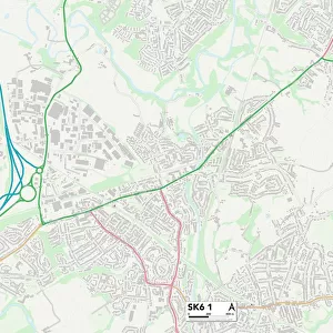
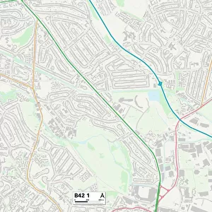
Birmingham B42 1 Map

![]()
Wall Art and Photo Gifts from Map Marketing
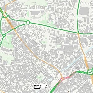
Birmingham B42 1 Map
Postcode Sector Map of Birmingham B42 1
Media ID 19964994
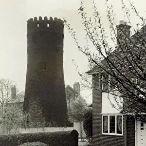
Alexander Gardens Birmingham Bradford Close Charnwood Road Fairview Avenue Gainsborough Road Grove Court Hillside Drive Langdale Road Raymond Avenue Rocky Lane Sandringham Court Sandringham Road Tower Hill Walsall Road Wensleydale Road Hamstead Hatton Gardens
FEATURES IN THESE COLLECTIONS
> Europe
> United Kingdom
> England
> Birmingham
> Area
> Hamstead
> Europe
> United Kingdom
> England
> Birmingham
> Area
> Newton
> Europe
> United Kingdom
> England
> Birmingham
> Area
> Perry Barr
> Europe
> United Kingdom
> England
> Birmingham
> Area
> Tower Hill
> Europe
> United Kingdom
> England
> Birmingham
> Area
> Walsall
> Europe
> United Kingdom
> Northern Ireland
> County Londonderry
> Coleraine
> Europe
> United Kingdom
> Scotland
> West Lothian
> Whitburn
> Map Marketing
> Postcode Sector Maps
> B - Birmingham
> Maps and Charts
> Related Images
MADE IN THE USA
Safe Shipping with 30 Day Money Back Guarantee
FREE PERSONALISATION*
We are proud to offer a range of customisation features including Personalised Captions, Color Filters and Picture Zoom Tools
SECURE PAYMENTS
We happily accept a wide range of payment options so you can pay for the things you need in the way that is most convenient for you
* Options may vary by product and licensing agreement. Zoomed Pictures can be adjusted in the Cart.