Home > Arts > Artists > V > Georges Villas
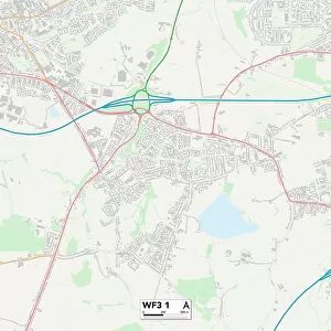
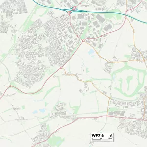
Wakefield WF2 7 Map

![]()
Wall Art and Photo Gifts from Map Marketing
Wakefield WF2 7 Map
Postcode Sector Map of Wakefield WF2 7
Media ID 19983250
Allerton Road Bull Lane Castle Avenue Castle Road Castle View Church Lane Clarence Road Clifford Avenue Field Lane Hastings Avenue Holme Lane Holmfield Avenue Kingsley Avenue Kingsley Close Lake View Lilac Avenue Lynwood Drive Major Street Melton Road Miller Avenue Monckton Road Newlyn Drive Pilkington Street Rivermead Rutland Avenue School Hill Seymour Street Sherwood Drive Slack Lane South Drive St Georges Walk Thornleigh Road Vaughan Way Vernon Place Wakefield Westbourne Close Wharncliffe Road Fawcett Street Portobello Sandal
FEATURES IN THESE COLLECTIONS
> Arts
> Artists
> V
> Georges Villas
> Europe
> United Kingdom
> England
> Rutland
> Related Images
> Map Marketing
> Postcode Sector Maps
> WF - Wakefield
> Map Marketing
> UK Maps
> Maps and Charts
> Related Images
MADE IN THE USA
Safe Shipping with 30 Day Money Back Guarantee
FREE PERSONALISATION*
We are proud to offer a range of customisation features including Personalised Captions, Color Filters and Picture Zoom Tools
SECURE PAYMENTS
We happily accept a wide range of payment options so you can pay for the things you need in the way that is most convenient for you
* Options may vary by product and licensing agreement. Zoomed Pictures can be adjusted in the Cart.