Home > Europe > France > Maps
Map of Europe in 1914, and Europe in 1932, from Histoire de la Troisieme Republique, Vol

![]()
Wall Art and Photo Gifts from Fine Art Finder
Map of Europe in 1914, and Europe in 1932, from Histoire de la Troisieme Republique, Vol
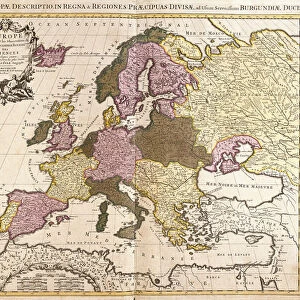
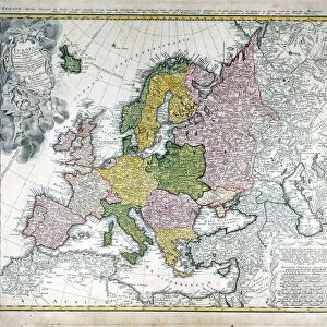
3504442 Map of Europe in 1914, and Europe in 1932, from Histoire de la Troisieme Republique, Vol. I, l Histoire Politique, pub.1933 (colour litho) by French Photographer (20th century); The Stapleton Collection; French, out of copyright
Media ID 22727144
© The Stapleton Collection / Bridgeman Images
FEATURES IN THESE COLLECTIONS
> Fine Art Finder
> Artists
> Percy J. Billingshurst
> Fine Art Finder
> Artists
> Photographer French
> Maps and Charts
> Related Images
EDITORS COMMENTS
This print showcases a fascinating comparison between the Map of Europe in 1914 and Europe in 1932. Taken from Histoire de la Troisieme Republique, Vol. I, l Histoire Politique, pub. 1933, this colour lithograph offers a glimpse into the ever-changing political landscape of the continent during that tumultuous period. In the first map depicting Europe in 1914, we witness a prelude to chaos as borders are clearly defined and countries stand proudly with their distinct identities. However, lurking beneath this seemingly peaceful facade lies an impending storm that would soon engulf the entire continent. Fast forward to 1932 and we see a drastically altered European map; it is marked by scars left behind by World War I and its aftermath. The once-sturdy borders have been redrawn or erased altogether as nations grapple with new realities brought about by conflict and shifting alliances. This thought-provoking image serves as a powerful reminder of how swiftly history can reshape our world. It prompts us to reflect on the consequences of war and political upheaval while highlighting the resilience of nations striving to rebuild amidst uncertainty. As we gaze upon this visual representation of change over time, let us not forget the countless lives affected by these transformations nor underestimate humanity's capacity for adaptation in face of adversity.
MADE IN THE USA
Safe Shipping with 30 Day Money Back Guarantee
FREE PERSONALISATION*
We are proud to offer a range of customisation features including Personalised Captions, Color Filters and Picture Zoom Tools
SECURE PAYMENTS
We happily accept a wide range of payment options so you can pay for the things you need in the way that is most convenient for you
* Options may vary by product and licensing agreement. Zoomed Pictures can be adjusted in the Cart.