Home > Europe > Italy > Lombardy > Milan
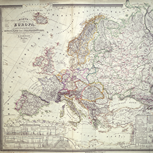
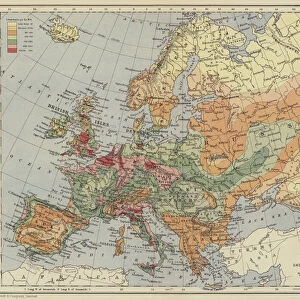
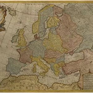
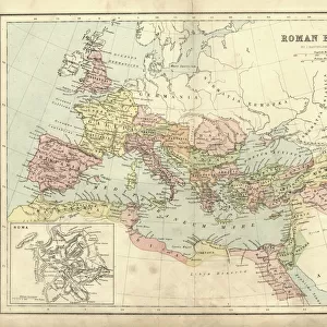
Map of Europe. Second half of the 19th century. Italian Atlas. Stabilimento Civelli

![]()
Wall Art and Photo Gifts from Fine Art Finder
Map of Europe. Second half of the 19th century. Italian Atlas. Stabilimento Civelli
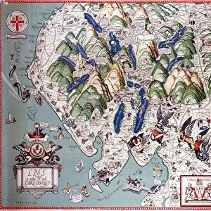
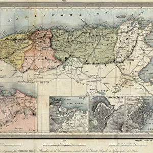
XEE4413272 Map of Europe. Second half of the 19th century. Italian Atlas. Stabilimento Civelli. Milan. by Unknown Artist, (19th century); Private Collection; (add.info.: Map of Europe. Second half of the 19th century. Italian Atlas. Stabilimento Civelli. Milan.); Stefano Bianchetti; out of copyright
Media ID 22759890
© Stefano Bianchetti / Bridgeman Images
FEATURES IN THESE COLLECTIONS
> Arts
> Artists
> Related Images
> Europe
> Italy
> Lombardy
> Milan
> Europe
> Italy
> Related Images
> Europe
> Related Images
> Fine Art Finder
> Artists
> Unknown Artist
> Maps and Charts
> Italy
> Maps and Charts
> Related Images
EDITORS COMMENTS
This print showcases a remarkable piece of cartographic history - a Map of Europe from the second half of the 19th century. Created by an unknown artist, this map is part of an Italian Atlas produced by Stabilimento Civelli in Milan. The intricate details on this map are truly awe-inspiring. Every country, city, river, and mountain range is meticulously engraved with precision and accuracy. It provides a glimpse into how Europeans perceived their continent during that era. The craftsmanship exhibited in this print is exceptional. The fine lines and delicate shading bring each region to life, allowing viewers to immerse themselves in the geography of Europe as it was over a century ago. Whether used for educational purposes or simply admired for its beauty, this map serves as both an informative tool and a work of art. Stefano Bianchetti expertly captures the essence of this historical artifact through his lens, preserving its rich heritage for future generations to appreciate. With copyright restrictions lifted, we can now enjoy and study this magnificent piece without limitations. As we gaze upon this Map of Europe from the 19th century, we are transported back in time - witnessing the political boundaries that have shifted since then while marveling at the enduring spirit that unites us all across nations and cultures.
MADE IN THE USA
Safe Shipping with 30 Day Money Back Guarantee
FREE PERSONALISATION*
We are proud to offer a range of customisation features including Personalised Captions, Color Filters and Picture Zoom Tools
SECURE PAYMENTS
We happily accept a wide range of payment options so you can pay for the things you need in the way that is most convenient for you
* Options may vary by product and licensing agreement. Zoomed Pictures can be adjusted in the Cart.